Atlases, maps, globes and educational materials from IAT.
Found: 298 products
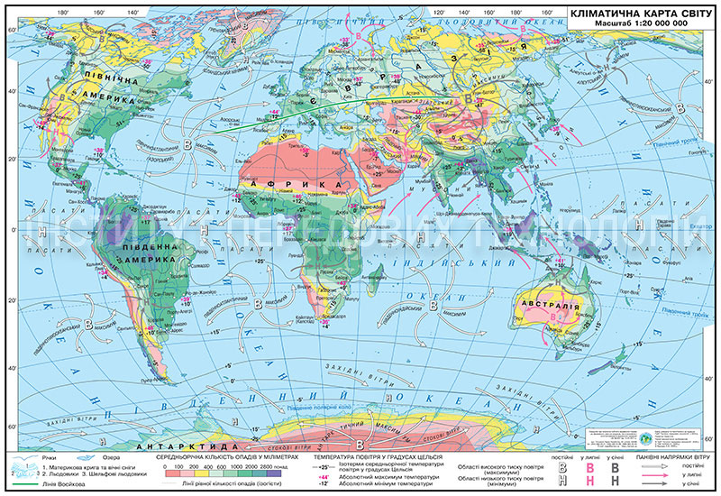
Laminated world climate map (160x110 cm, 1:22 000 000) for grades 7–9 geography classrooms. Displays climate zones according to the Köppen classification, avera…
Climatic educational world map (160x110 cm, 1:22 000 000) with strips for grades 7-9. Illustrates Köppen climate zones, average temperatures, and precipitation.…
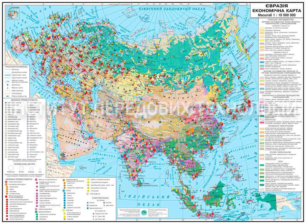
Paper economic map of Eurasia (160x110 cm, 1:10,000,000) for Grades 9-11 geography classrooms. Displays industrial centres, transport corridors, energy resource…
Economic map of Eurasia (160x110 cm, 1:10,000,000 scale) for Grades 9-11 geography classrooms. Details industrial centers, transport corridors, energy resources…
Economic map of Eurasia (160x110 cm, 1:10,000,000 scale) on strips for Grades 9-11 geography. Shows industrial centers, transport routes, resources, and agricul…
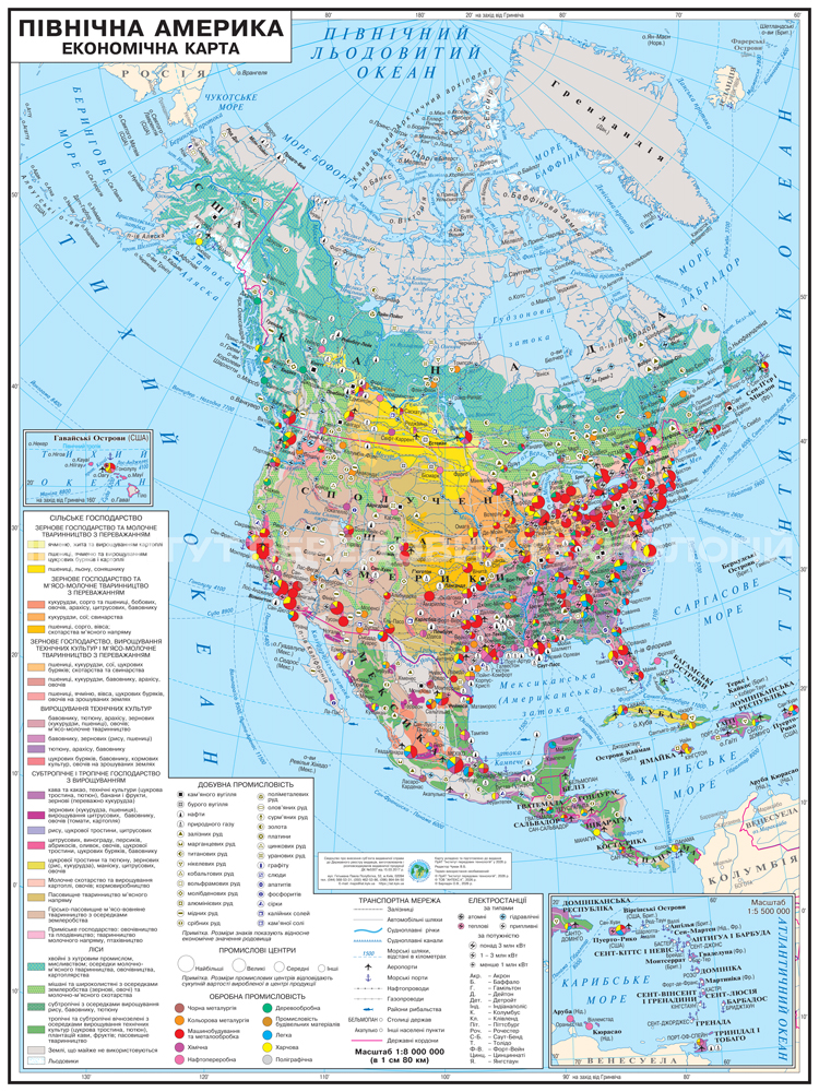
Economic map of North America (105x140 cm, 1:8,000,000) on laminated paper for detailed analysis of the continent's economy. Displays productive forces, resourc…
Wall economic map of North America (105x140 cm, 1:8,000,000) with plastic strips for easy hanging. Illustrates the continent's resource base and logistics infra…
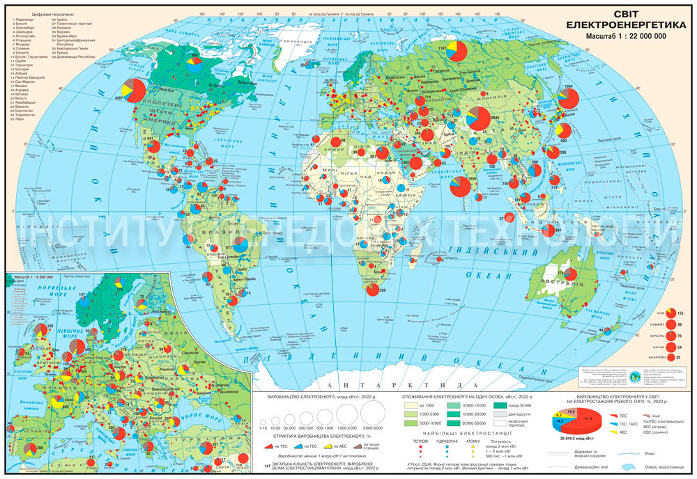
Educational world electricity map (160x110 cm, 1:22,000,000 scale) for geography classrooms. Illustrates electricity production and consumption by country using…
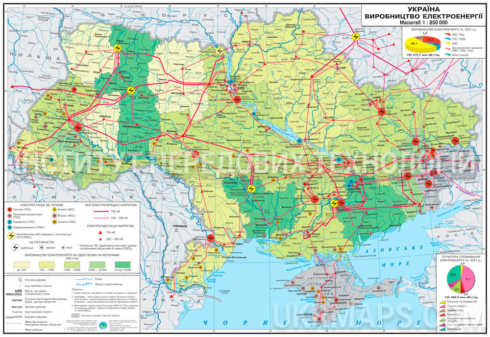
Educational map of electricity production in Ukraine (160x110 cm, 1:850,000 scale). Shows power plants, transmission networks, and regional consumption. Designe…
Educational map of electricity production in Ukraine (160x110 cm, 1:850,000 scale) on strips. Displays power plants and transmission networks for schools and an…
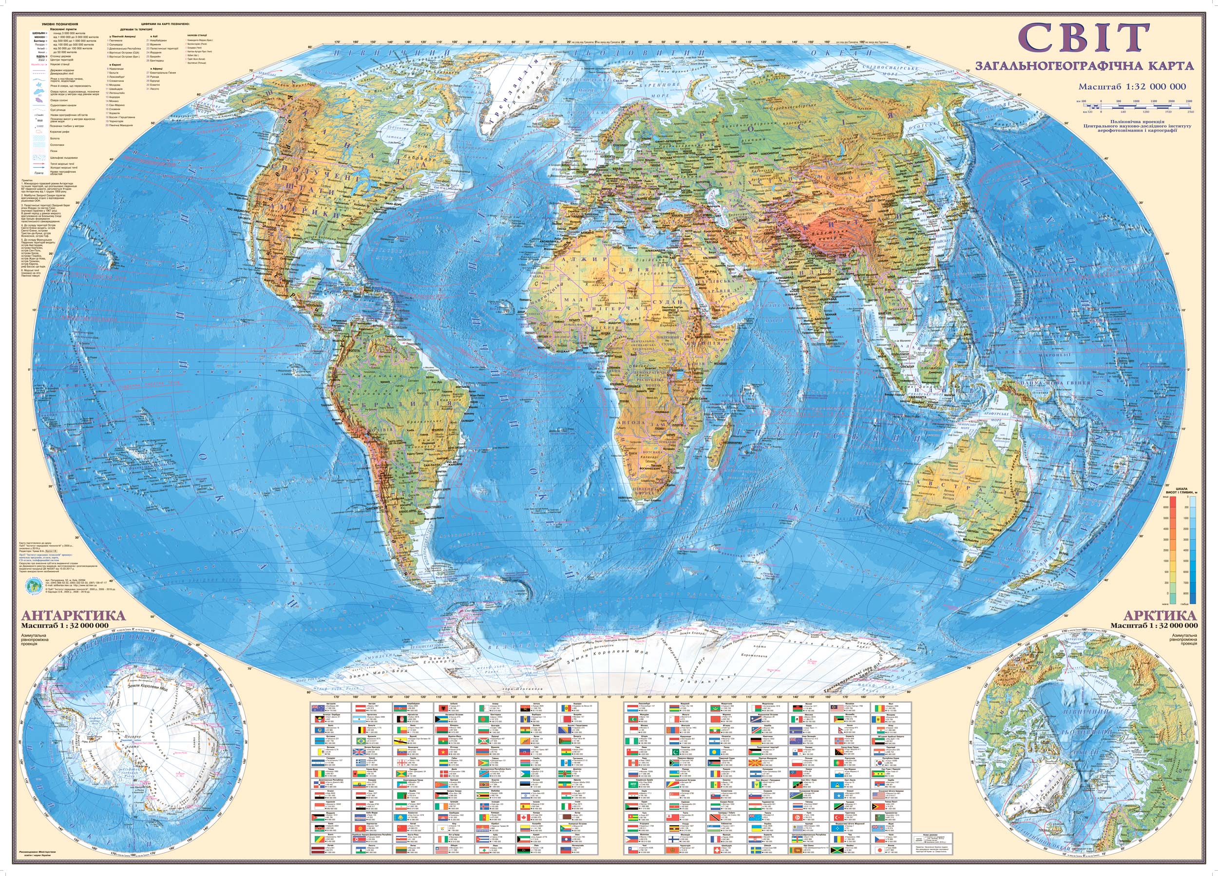
General geographic world map (110x80 cm, 1:32,000,000) on cardboard with strips — for geography classrooms. Features physical relief, hydrography, and country n…
General geographic world map (110x80 cm, 1:32,000,000) on laminated cardboard — for geography classrooms. Combines physical relief, hydrography, and country nam…
General geographic world map (110x80 cm, 1:32,000,000) on laminated cardboard with strips — for schools. Displays relief, hydrography, and borders. Lamination p…

General geographic world map (158x107 cm, 1:22,000,000) on cardboard — for geography classrooms. Combines physical relief, hydrographic networks, and country na…
General geographic world map (158x107 cm, 1:22,000,000) on cardboard with strips — for educational institutions. Displays relief, hydrography, and states. Cardb…
General geographic world map (158x107 cm, 1:22,000,000) on laminated cardboard — for geography classrooms. Shows relief, hydrography, and countries in detail. A…
General geographic world map (158x107 cm, 1:22,000,000) on laminated cardboard with strips — for schools. Combines relief, hydrography, and country names. Lamin…
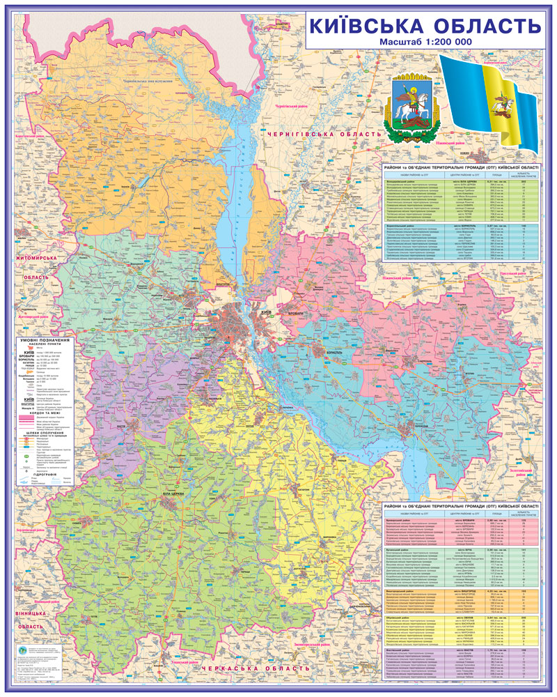
Administrative and territorial map of Kyiv region (140x112 cm, scale 1:200,000) on laminated paper with strips for offices and educational institutions. Details…
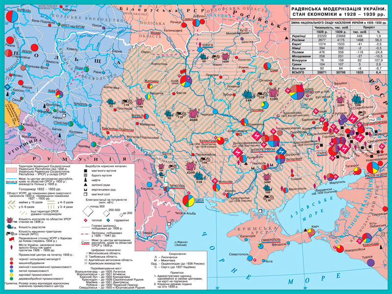
Educational map of Ukraine's Soviet modernization and industrialization (1928–1939) at 1:550,000 scale (100x70 cm). Designed for history teachers. Shows industr…
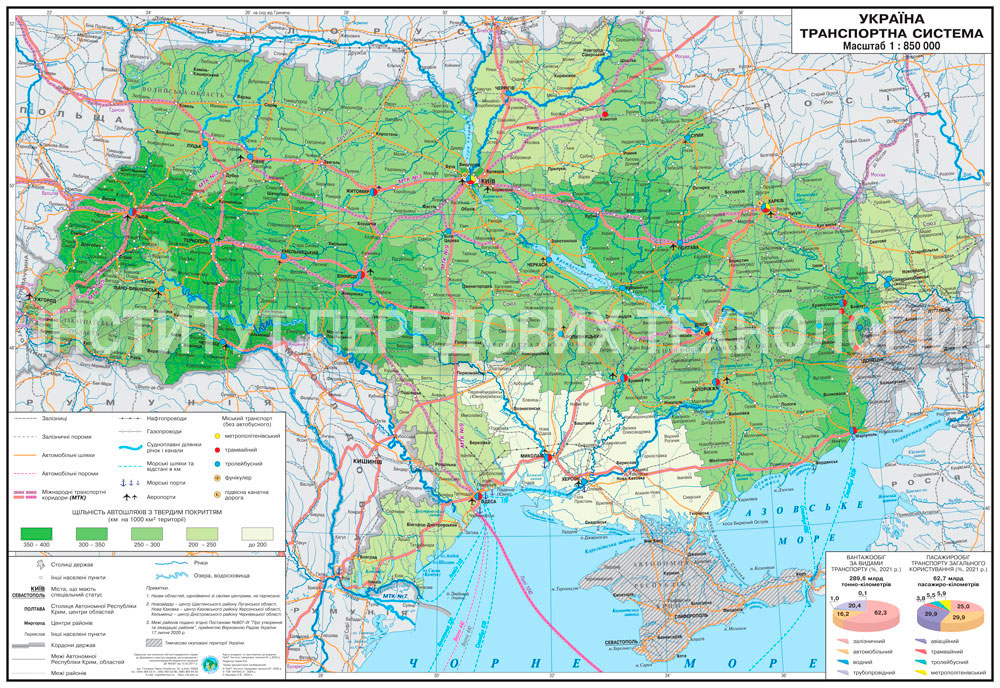
Educational transport system map of Ukraine (160x110 cm, 1:850,000 scale) for Grades 9-11. Displays road, rail networks, sea and river routes, airports, and pip…
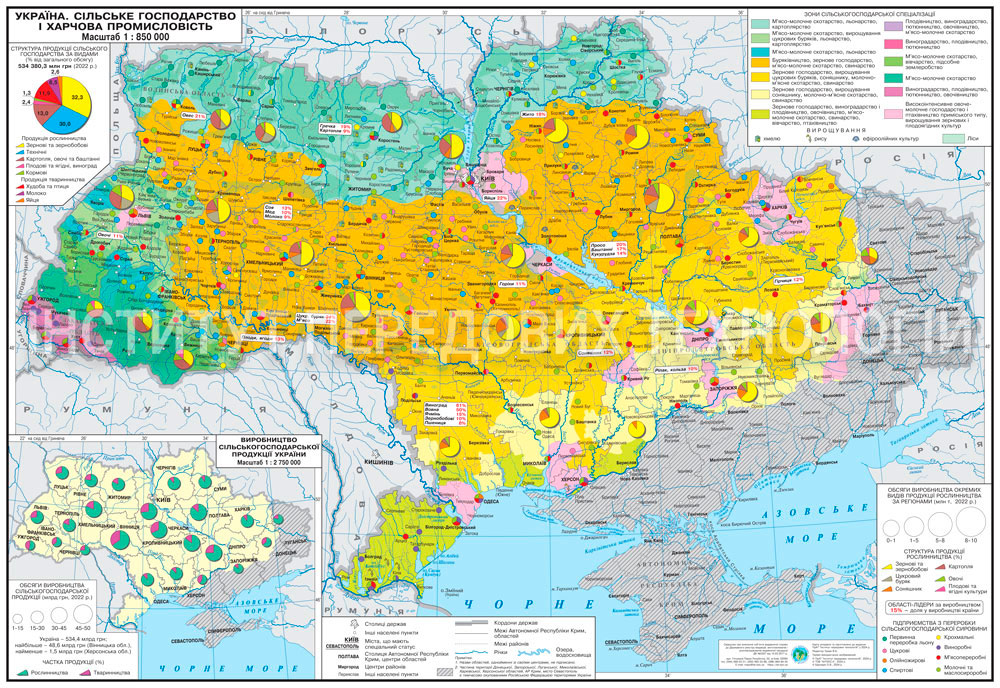
Educational map of Ukraine's agriculture and food industry (160x110 cm, 1:850,000, laminated) for Grades 9–11 geography classrooms. Demonstrates agricultural zo…
Educational map of Ukraine's agriculture and food industry (160x110 cm, 1:850,000) on strips for Grades 9–11 geography. Shows agrarian zones and food industry e…
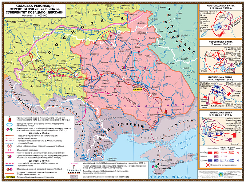
Educational historical map "Cossack Revolution of the mid-17th Century" for grades 7–11. Size 145x108 cm, laminated. Shows event routes, administrative division…
Educational historical map "Cossack Revolution of the mid-17th Century" for grades 7–11. Size 145x108 cm, with mounting strips. Shows event routes, administrati…
Category
Grade
Map type
Finish type
Price
