
Maps
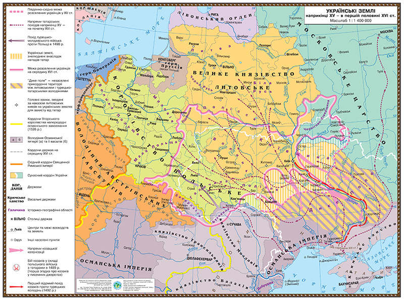
Map of Ukrainian lands in the late XV - first half of the XVI century 145*108 laminated
Educational historical map "Ukrainian Lands in the Late 15th - First Half of the 16th Century". Size 145x108 cm, laminated surface. Depicts borders, cities, rivers, and other important geographical features of the Ukrainian region of that era.
Price:650 грн
Specifications
- Size:
- 145×108 cm
Price650 грн
Buy on Ukrmaps.com