
Maps
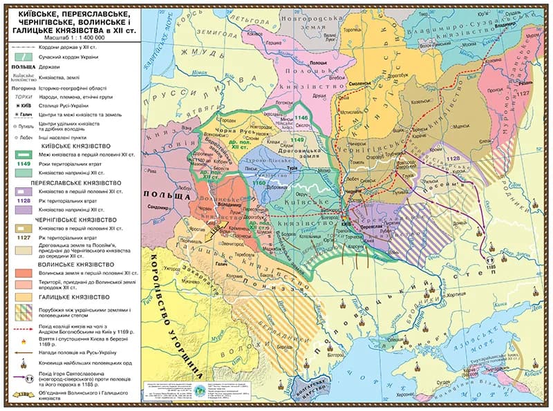
Map of Kyiv Pereyaslav, Chernihiv, Volyn and Galician principalities in the twelfth century 145*108 laminated
Educational historical map for grades 7–11 depicting Ukrainian principalities in the 12th century. Size 145x108 cm, laminated surface. Shows administrative divisions, geographical features, and routes of Kyiv, Galician, and other principalities.
Price:650 грн
Specifications
- Size:
- 145×108 cm
Price650 грн